
The United States has over 94,000 dams with an average lifespan of more than 53 years. These dams provide storage for water and irrigation, flood control, opportunities for recreation, improve water quality, and in instances where the dams are equipped with hydropower generation equipment, provide renewable, carbon free electricity.
Every dam has a different age, size, engineering complexities, and hazard potential. Due to the unique design of each dam, the challenges posed by climate change have exacerbated dangerous conditions. With altered rainfall patterns and extreme weather events becoming more commonplace, dams are increasingly stressed by flooding events, which can threaten spillways and cause structural failures; conversely, the effects of drought, which lower water levels, create unsustainable conditions for electricity generation.
To better understand the complexities of dam operation and evaluate the factors threatening a dam’s integrity, risk assessments are conducted by engineers and owners/operators. Each dam is classified by its level of hazardous impact (low, significant, high), which correlates directly to the danger it would pose to human life if a breach were to occur. These detailed dam safety inspections are laborious, time-consuming affairs, and they can also pose safety risks to the personnel conducting the assessments due to the potentially dangerous environments (dam embankments, below waterline areas, and inside of pipes) where the inspections occur.
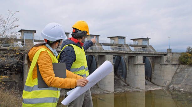
Engineers consult plans during a dam safety inspection.
There are multiple kinds of inspections, ranging from frequent and informal observations to detailed reviews. Dams should have an in-depth technical inspection every five years, standardized inspections after earthquakes or other natural disasters, and a yearly detailed inspection from the owner of the dam. Further inspections may also be required depending on each specific state. For example, Massachusetts dam owners are required to hire a qualified engineer to inspect dam facilities for high hazard potential every two years, conduct a significant hazard inspection every five years, and a low hazard potential inspection every ten years.
Fortunately, the benefits of modern innovation are such that once perilous tasks for humans have been reworked to utilize drones and other technology, enabling faster, safer, and more affordable solutions for owners conducting dam safety assessments – whether from the air or underwater.
By developing a deeper understanding of the range of drone-based solutions options available to inspectors, owners and operators can better identify solutions to fit the unique nature of projects.
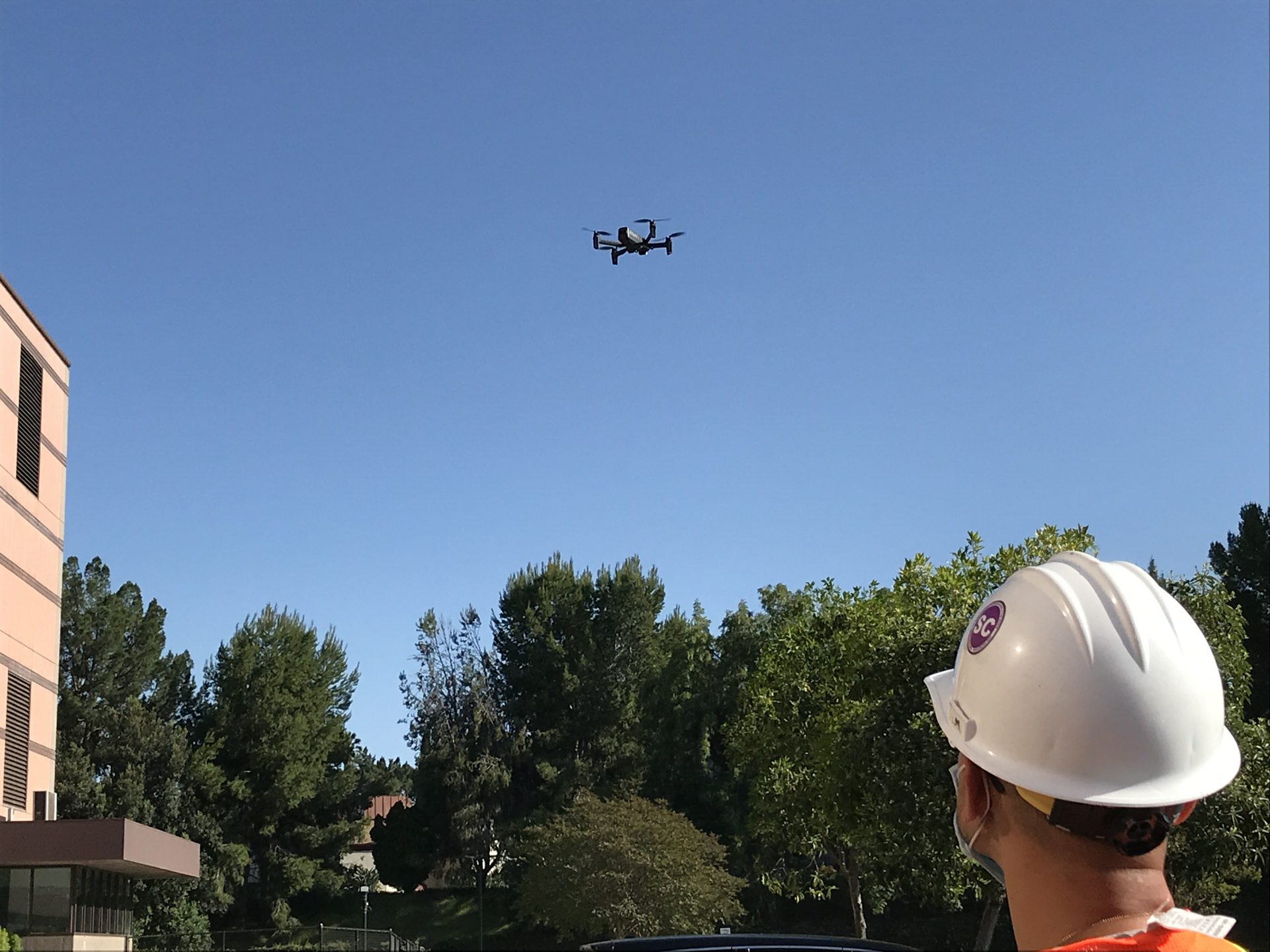
An SCE engineer practices piloting an unmanned aerial vehicle (UAV).
THE APPLICATION OF AERIAL DRONES IN DAM SAFETY INSPECTION
While unmanned aerial vehicles (UAV) technology has existed in various iterations since the 1800’s – largely in the form of weapons of war (incendiary balloons, aerial torpedoes) – the first commercial drone applications began in 2006, which is when the Federal Aviation Administration issued its first drone permit. The technology was initially relegated to disaster relief, border surveillance, and pipeline inspections.
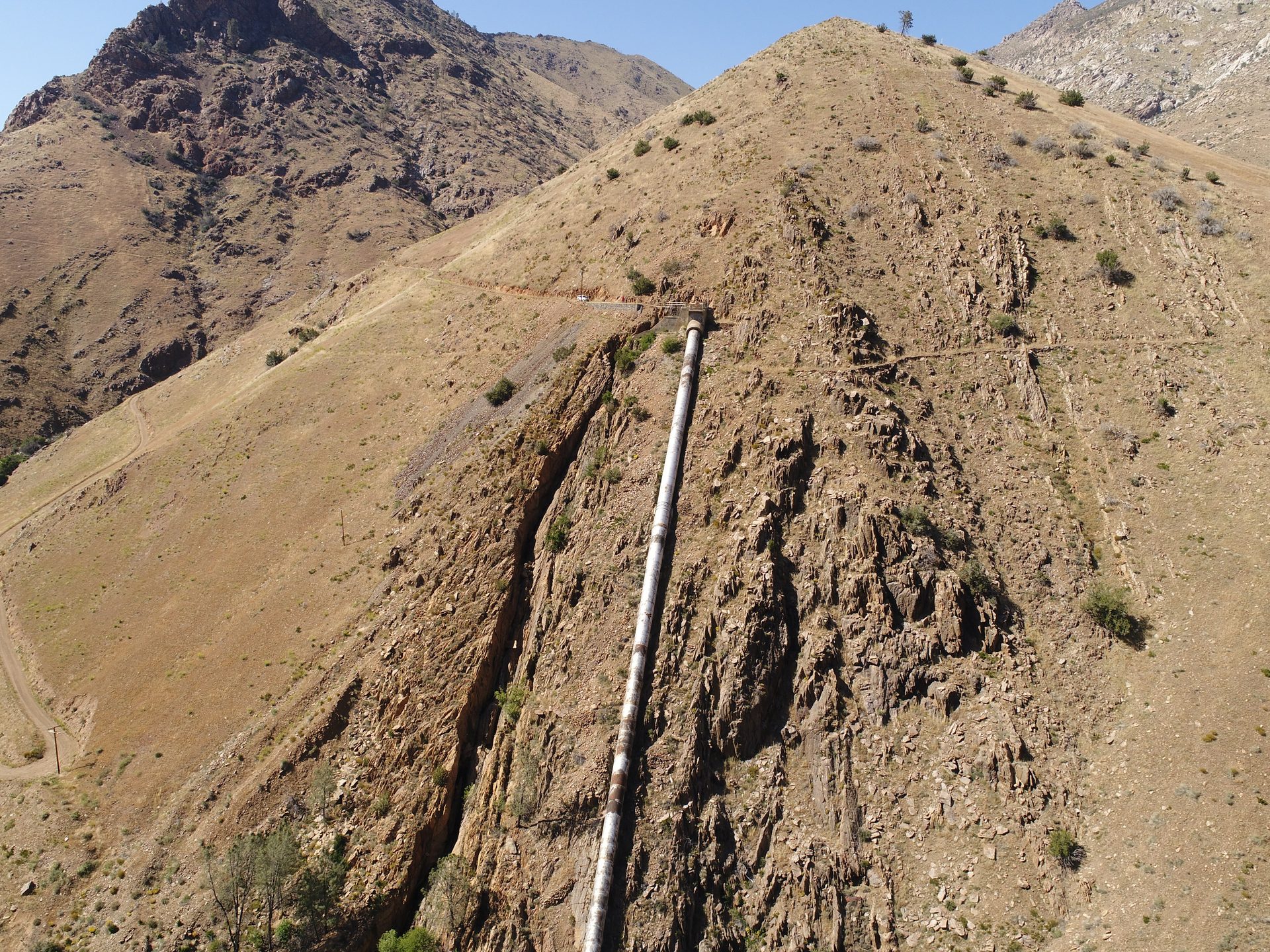
Photograph from drone flight during a pipeline inspection.
Fast forward to 2021, the Federal Aviation Administration reported there are nearly 900,000 drones registered in the United States and more than half of that number are for recreational use. The drone market is valued at around $10 billion, and as the technology becomes increasingly affordable, drones are expected to fill multi-faceted roles – crop fertilization, traffic monitoring, deliveries, and surveyance of hard-to-reach areas.
With the rise of varied drone applications, dam owners and operators have taken notice. The Tennessee Valley Authority (TVA) runs a team called the TVA Unmanned Aircraft Systems (UAS), and they partnered with teams from dam safety, facilities management, and GP&FS environmental support to test the applicability of drone-based herbicide applications in a bid to control vegetation growth on embankment dams.
Matt Huebner, the senior geologist for the dam safety team, spoke about the important work the drones perform, “Vegetation control at embankment dams is crucial, as the root systems of trees and heavy brush on and near embankment dams can create potentially hazardous dam safety issues.”
Prior to the drone program, TVA employed personnel to equip heavy backpack sprayers to walk the dam’s face, spraying herbicide to remove vegetation. Due to the inherent dangers posed to humans by the coarse riprap and rockfill on the embankments, stinging insects, venomous snakes, and loose rocks, the facilities personnel took several days to complete the work.
While TVA had completed hand removal of the vegetation in early FY22, the vegetation control requires periodic herbicide spray to control regrowth and prevent larger vegetation from posing a threat to operations. By utilizing the drone-based herbicide application, the pilot program was able to cover 35 acres in four days.
A TVA employee flies a drone as part of the vegetation control program.
Reflecting on the program’s success, Huebner said, “In addition to alleviating the obvious dam safety concerns, drone-based herbicide application is efficient, cost effective, and will reduce risk to personnel safety. We’re already thinking of where we can go next.”
Beyond vegetation control, unmanned aerial vehicle drones have seen widespread utilization across the hydropower industry, largely in the form of infrastructure assessments, as the drones can be equipped with a host of sensors, cameras, acoustical equipment, infra-red lenses, and the ability to physically interact with dams. The low-cost, low-skill, and immediate deployment benefits of drones have proven invaluable to an industry accustomed to relying on human operators to place themselves in potentially dangerous scenarios. Simply put, unmanned aerial vehicles represent a safer, faster, and more affordable alternative to traditional dam safety inspections.
The Diablo Dam, owned and operated by Seattle City Light, located in the North Cascade mountains of Washington state, is a 389-foot dam which provides electricity to Seattle. Taking advantage of modern drone technology, Seattle City Light augmented traditional dam safety inspections with drone surveys.
To further illustrate the effectiveness of the drone surveys, a two-hour flight collected more than 80 million data points from the arch dam, spillways, and rock abutments. Using this information, a 3-D model was created to depict the drones’ analysis. In addition, the drone took high-definition photographs, which documented the dam’s condition to provide a baseline for future observations. The data collected by the drone formed the basis of a high-resolution virtual model of the dam, which has been used to identify potential surficial cracks. When paired with artificial intelligence and machine learning programs, the drone collected data is being utilized to ‘teach’ future incarnations the skill of reliably identifying concrete deterioration.
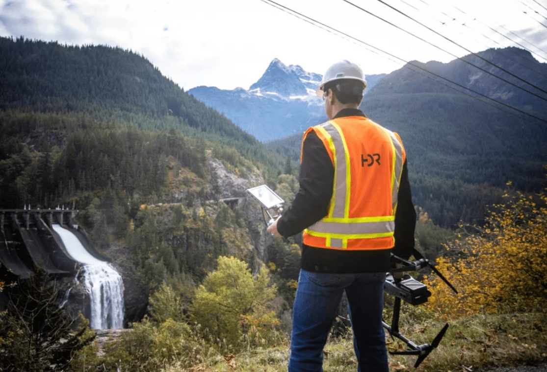
A drone operator surveys a spillway, drone in hand.
Dam owners and operators interested in applying drone technology to dam safety assessments should consider the below workflow, which lays out how to best take advantage of the drone’s strengths. The following steps allow companies to create high resolution models and images of dams, as well as analyze data points to accurately define potential problems and work on solutions for safety checks.
- Data collection
- Data pre-processing that entails 3D modeling and orthographic projections
- Data processing where models are checked for defects
- Quality checks that allow for combing of false positives and negatives as well as a quality check on the resolution of 3D mapping
- Upload and analytics that provide visualizations of all layers.
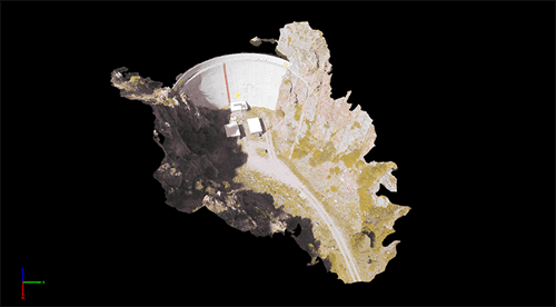
3-D generated model of a dam created from drone collected data.
UNDERWATER REMOTE OPERATED VEHICLES AS PROBLEM SOLVERS
With the rise of drone technology, the hydropower industry has celebrated the utility of remote operated vehicles (ROVs), which are user-controlled machines designed to operate underwater. While numerous models exist, most of the remote operated vehicles used in hydropower environments have internal and rechargeable power supplies, tilting cameras, ports for external attachments (grippers, sonar, lights, navigation equipment, and sensors), and can be operated with smartphone displays.
To better understand how remote operated vehicles are serving the needs of the hydro industry, Clark Public Utilities (CPU), a publicly owned utility in Vancouver, Washington, serves as an excellent example.
Clark Public Utilities operates 35 reservoirs, with the largest reservoir containing over 3 million gallons of water. Due to routine safety and maintenance inspections, Clark Public Utilities would drain its reservoirs beforehand. The continuous cost of shutting down and draining reservoirs started to add up. With draining and re-filling taking up to 16 hours to complete, coupled with the expense of dumping water that could otherwise be turned into renewable electricity, Clark Public Utilities started researching alternatives, which is when they came across remote operated vehicles as a potential low-cost and time-saving solution.
The model selected came from company Deep Trekker, a manufacturer of the DTG2 ROV, which is a unit commonly used to inspect hydroelectric facilities, reservoirs, and portable water systems across the United States. Capable of operating for up to 8 hours on a 90-minute charge, the DTG ROV allowed Clark Public Utilities to keep reservoirs online and avoid any community-impacting shutdowns, as the remote operated vehicle could perform in-depth reservoir analysis without the cost and service interruptions draining incurred.
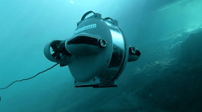
A Deep Trekker drone examining a dam embankment.
While the remote operated vehicle performed reservoir inspections, the drone operators noticed floating debris, so the decision was made to equip the ROV with a boom to push the debris to the surface, where it was removed. The ROV performed so admirably during this task that it quickly became the default tool for both inspections and debris removal, reducing costs for Clark Public Utilities while keeping rates low for customers.
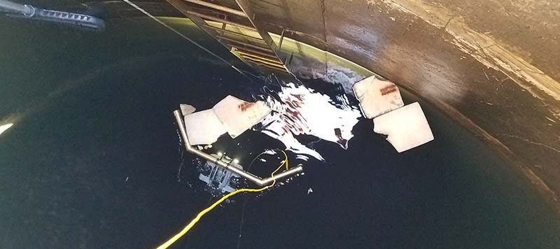
Photograph of Clark Public Utilities’ Deep Trekker drone assisting in the removal of underwater debris.
In addition to the application of remote operated vehicles as tools of inspection and debris removal, owners and operators have been outfitting ROVs with sonar technology to great effect. For instance, Dutch company H20 Drones has equipped remote operated vehicles with sonar, and the dam inspections the drones perform has proven to be invaluable.
In one instance, the H20 Drone team had been called in to examine a steel wall dam because a subsidence of pavement was apparent behind the quay. While the cause of the subsidence was unknown, the dam wall showed no visible defects, but the inspection told a different story.
After exploring the area with remote operated vehicles, the operators discovered that large sink holes – created by the propellers of moored boats – had appeared in front of the dam wall. To make matters worse, the dam wall had partially collapsed 6 meters below the water level, sagging more than 80 centimeters, which in turn had created the subsidence of pavement behind the quay.
Due to poor visibility in the water, the necessary inspections to evaluate the dam couldn’t be performed up close, so sonar was selected as the ideal tool. After sending a sonar equipped remote operated vehicle to evaluate the dam, a failure in the dam wall at a depth of five meters was discovered. This discovery was possible due to three factors:
- The remote operated vehicle
- Drone-connected sonar
- The drone operator’s competency
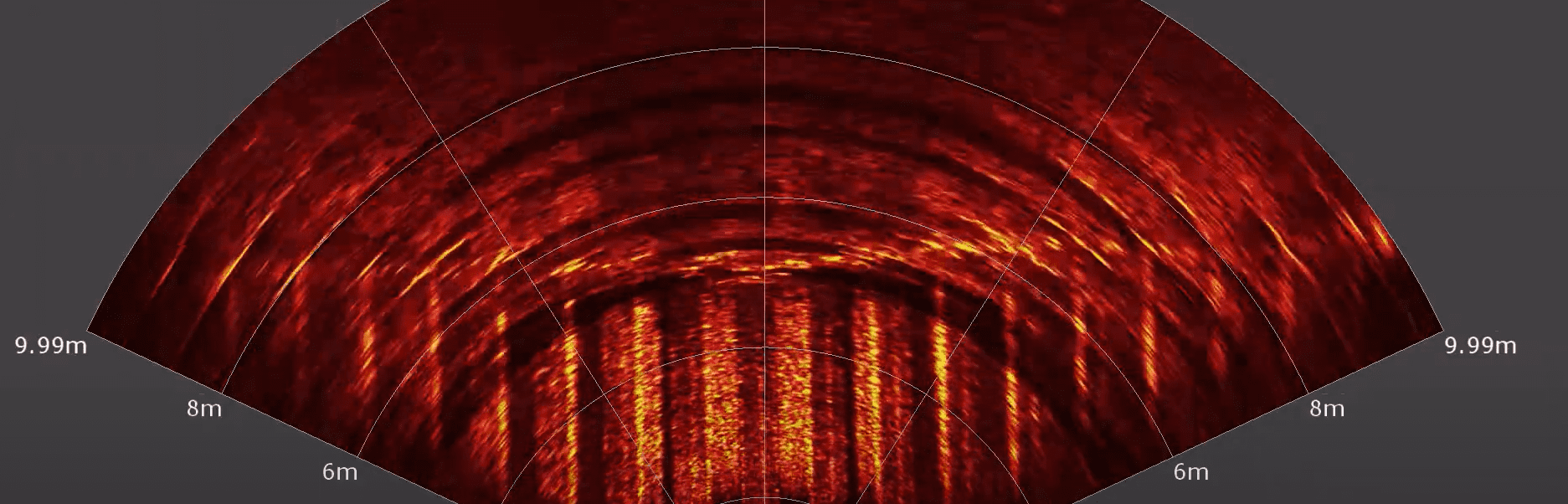
Sonar readout of dam embankment wall from drone connected sonar device.
With certain remote operated vehicles capable of stationary positioning, meaning they can lock themselves in a fixed location for long durations, the operator was able to take advantage of the drone’s rotating camera to scan the dam wall from one location to another. When stationed at the appropriate distance, the H20 Drone team were able to build out a complete sonar reading of the dam, enabling the discovery of the failure, which would not have been detectable otherwise.
FOR MORE INFORMATION
The possibilities of drone applications are limitless. Compared to in-person dam safety inspections, drones are faster, safer, more accurate, predictive, and allow for a repeatable inspection process. Drones are also a financial and time-saving investment, and they can perform highly detailed work quickly while accessing difficult to reach locations, enabling owners and operators to keep operations online while the drones perform assessments. The future of remote operated vehicles and drone mapping for dam safety remains bright, as the technology helps owners and operators maintain infrastructure integrity.